Inspection begins by reducing exposure
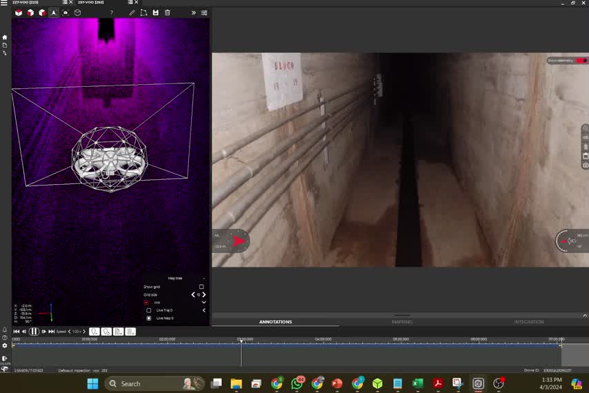
Tunnels, silos, galleries and underground structures may combine low visibility, dust, obstacles and restricted access. A confined-space drone can perform remote reconnaissance before people approach critical areas.
Data to analyze, measure and document
LiDAR sensors and cameras turn each flight into a visual and spatial engineering record.
- Images and video of observed conditions
- Point clouds for measurements and modeling
- Auditable records for reports
- Reduced need for preliminary manual access
Engineering planning remains essential
Technology does not replace engineering. Each mission must consider the environment, risks, sensor positioning and the deliverable required by the client.
Need this expertise in your project?
Talk to CCMENG to assess your data, objectives and the most appropriate engineering approach.
Talk to a specialist↗